Facilities
McPhail Center for Environmental Studies
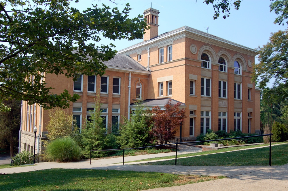
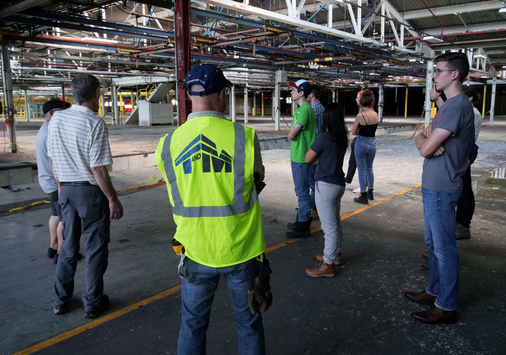
The renovation of Barney Memorial Hall restored the historic character of the building and now houses the McPhail Center for Environmental Studies and the English Department. The Barney renovation project produced a place where environmental principles are upheld and demonstrated to the community.
Upon the announcement of the gift, Environmental Studies Professor, Dr. Abram W. Kaplan said “Our growth has been phenomenal, and this is an incredible opportunity to build a Center that can both showcase an impressive array of environmental innovations and serve as a laboratory for learning about various aspects of the field.
“It was my intent to provide Denison with a new capability to suit a new era, it's all a matter of supply and demand. Industry is giving increasing recognition to the discipline, and if Denison is going to be serious about educating people to be leaders in it - people who are well trained, competent, and have the big picture - then it is essential for the program to have a Center like this as its home,” McPhail said.
McPhail is an entrepreneur and the founder of Lectron Products Inc. which is a successful original equipment manufacturer of electronic and electro-mechanical products for the automotive industry. Today he is the president of the McPhail Corp. of Rochester Hills, Michigan, as well as several other corporations dealing with aviation and real estate.
This project was especially distinctive because it recycled (reused) an existing building, instead of constructing a new building from the ground up. The new Barney-Davis Hall is a showcase for the reuse of an existing structure, energy-efficiency, sustainability, renewable resources, the reduction of toxins, and the recycling of wastes.
The Barney renovation project was a real-life exercise in environmental education for the students and community of Denison University, and is now used as a working laboratory for education and research. In 1999, a senior Capstone Seminar group performed a Post-Occupancy Evaluation of the newly renovated Barney-Davis Hall.
The McPhail commitment on behalf of the Environmental Studies Center complements another gift to the program given by Anne Powell Riley, class of 1953. This donation funded the Directorship of the program which is held by Abram Kaplan. An additional commitment from Jeanette Davis, class of 1924, went toward further renovations within the building.
Denison's Biological Reserve was established by the Board of Trustees in 1966 through the efforts of Professor Robert Alrutz, who served as director until his retirement in 1990. The Reserve encompasses 350 acres in three contiguous sections that are within easy walking distance of campus. Approximately 75% of the acreage is beech-maple/mixed mesophytic forest interspersed with old orchards and former plantations of pine, spruce, sugar maple and yellow poplar. Late successional habitats are characteristic of those disturbed by grazing over 50 years ago. In the Alrutz Section, three former agricultural fields are maintained in various stages of succession by seasonal mowing. Clay Run, along with four ponds and seven natural springs provide habitat for aquatic organisms. The Reserve provides refuge for numerous amphibians, turtles, snakes, bats, rodents, flying squirrels, white-tailed deer, red fox, and over one hundred species of birds.
Biological Reserve
The purpose of the Reserve is to enhance the education of students in Biology and the Environmental Sciences through their courses, independent research and casual visitation to the Reserve. This is accomplished by providing opportunities for field studies of native Ohio flora and fauna as well as discrete biological communities that are maintained in as intact a condition as is possible given the land use history of the Reserve and the resources of DU. Consequently, one of the general goals of the Reserve is to maximize the number of representative habitats and species that the area can support.
Hibbs Library Resources
The Hibbs Library is located on east side of the first floor of the Barney-Davis building. Hibbs offers multiple useful study resources not only for class research and projects, but also for individual reading and career planning. The library contains a wide variety of environmental journals, newsletters, and books. Job and internship listings are also available in the library. Students interested in pursuing an Abroad Program can browse through materials that past students have donated Hibbs.
In addition to offering an extensive array of research sources, the Hibbs Library provides students a quiet place to study and read. Tables, couches, and chairs line the room so students can choose which set-up is most effective for study or meeting needs. With windows facing the east and south, the space is full of natural sunlight throughout most of the day. The natural look of the old wooded framing gives the room a calm and relaxed atmosphere.
Various meetings occur in Hibbs throughout the day because of its location. It is removed from the noise of the hallways and classrooms. Students and faculty often gather here for organizational meetings, class projects, or just for lunch.
GIS Lab
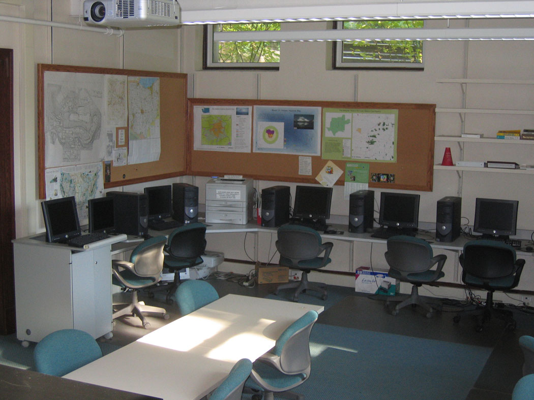
The Environmental Studies Program has established a high end Geographic Information Systems (GIS) laboratory in Barney-Davis Hall. We have invested more than $150,000 in our lab, thanks to the generosity of the Bingham Foundation and the Denison administration.
The lab is equipped with 16 Dell workstations with flat screen monitors, a large-format digitizing tablet (used to convert large hard copy maps into digital form), a production-quality HP DesignJet 455CA color plotter, a high resolution Epson Stylus Photo 1280 color inkjet printer, a black-and-white HP LaserJet printer, Garmin GPS units, and a Sharp LCD projector linked to a teaching computer for heads-up instruction. GIS and ecosystem modeling software used in the lab includes the full suite of ESRI ArcGIS, IDRISI, and STELLA.
GIS allows maps to be rendered in digital form and used for various kinds of record keeping and analysis. Though people do not conventionally think of issues this way, almost any conflict or environmental issue can be examined from a geographic point of view it is almost always about a place, locally or regionally defined. GIS allows the user to establish multiple map layers about that place, combine these base layers through overlay analyses to create “new” layers, and then examine the integrated data for common patterns that might be useful in improving a situation. So, for instance, GIS is increasingly used in projecting development patterns in rural and suburban areas. With map layers of roads, soils, hydrology, existing land uses, zoning regulations, and other features of the landscape, a plan can be established that gives greater priority to agricultural land preservation than a non-GIS-based analysis might create. GIS is used to establish buffer zones for endangered species, models of pollution flow from oil spills, and intergovernmental control of protected harbors. It allows testing of scenarios that are typically impossible otherwise, given the number of spatial parameters and unique combinations of features.
GIS is probably the single most important advancement in environmental analysis over the past twenty years, and this technology is already transforming the opportunities for research, career paths, and policy initiatives worldwide. The sooner future environmental professionals can be introduced to this critical innovation, the better success we can expect in solving environmental problems. Denison is well positioned to be a leader in providing these skills.
Denison currently offers two courses in GIS, Introduction to Environmental Mapping and Advanced GIS. Students learn to create a GIS database from scratch, using hardcopy maps and aerial photos as well as satellite imagery and digital databases, such as those available from government agencies like the US Geological Survey. Once created, these databases are used in sophisticated suitability models for real-world applications in the local community. Along the way, students learn the importance of metadata, scale, accuracy, precision, and projections and coordinate/reference systems in a GIS analysis, in addition to acquiring skills such as digitizing, editing, resampling, and database management (integrating tabular attributes, such as names of buildings, species of trees, widths of roads, etc.). Many students from these classes are qualified to make full use of GIS in careers and graduate programs, and their qualifications are already superior to the majority of undergraduates seeking employment and continued study in the environmental arena.
GIS is certainly not the singular focus of Environmental Studies, and ES majors are not required to gain expertise in this technology. But acquiring this advanced GIS technology has allowed us to foster innovative interdisciplinary education that gives Denison students, faculty and the local community some tremendously powerful opportunities that are rarely available in the realm of liberal arts education.
 and his team at Purple Orange played a key public relations role in what might be the marketing coup of 2023 — the Solo Stove endorsement made by rapper Snoop Dogg. (Lindley Rust)")